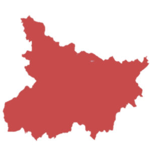
Capital : Patna
Statehood : 26 January 1950
Area : 94,163 km2
Bihar is the 13th largest state by area.
Population : 10 + crores
Based on 2011 census, population in Bihar is more than 10 crores and ranks 3rd position. Therefore the population density is 1102 persons per square kilometer.
Language : Hindi
हिन्दी
Below are the letters in Hindi:
अ आ इ ई उ ऊ ए ऐ ओ औ अं अः ऋ
क ख ग घ ङ
च छ ज झ ञ
ट ठ ड ढ ण
त थ द ध न
प फ ब भ म
य र ल व
श ष स ह
क्ष त्र ज्ञ
Number of Districts : 38
Below are the districts in Bihar
- Araria
- Arwal
- Aurangabad
- Banka
- Begusarai
- Bhagalpur
- Bhojpur
- Buxar
- Darbhanga
- East Champaran (Motihari)
- Gaya
- Gopalganj
- Jamui
- Jehanabad
- Kaimur (Bhabua)
- Katihar
- Khagaria
- Kishanganj
- Lakhisarai
- Madhepura
- Madhubani
- Munger (Monghyr)
- Muzaffarpur
- Nalanda
- Nawada
- Patna
- Purnia (Purnea)
- Rohtas
- Saharsa
- Samastipur
- Saran
- Sheikhpura
- Sheohar
- Sitamarhi
- Siwan
- Supaul
- Vaishali
- West Champaran
Vehicle registration code: BR
Literacy rate : 63%
According to 2011 census, Bihar stands 29th in literacy rate.